Paphos Country Sightseeing
Roudia Bridge

From Vretsia it is a very pleasant if somewhat bumpy drive to Roudia Bridge. This is one of several Venetian Bridges dotted throughout Paphos Forest and beyond. They formed the Camel Trail, which was the route minerals mined in the mountains went to get them to the sea. The bridges tend to be hump-backed. This lets camels walk over them during winter time, but gives them enough room to walk along the riverbed during the dry summer months. Roudia itself wasn't always this well preserved. I have seen a picture from the 50s where you can see the top portion was missing.

Annoying Habit

This drives me nuts. Roudia Bridge is an historical relic. However, it also has water, so receives regular visits from the ministery who sprays the area to prevent insects, presumably mosquitoes. Nothing annoying so far, but they insist on writing the date and initialling it on each visit. And they write it on the wall of the bridge itself!
Oh come on! Surely the workers have mobile phones. Could they not just take a timestamped picture of the bridge? Why deface it with all these scribblings?
Information

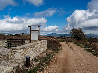
There is an Information Sign here too, so they must know it is historically important.
The "Venetian Bridges" Nature Trail, connects three bridges (Roudias, Tzelefos and Elias), which were constructed when Venetians controlled the island (1489-1571), to serve access and trade needs of the nearby population.
The trail was part of the old route for the transportation of copper from "Pera Pedi" mine to Pafos Port. The transportation was carried out by camels to "Pera Vasa" where the ore was primarily treated. then it was carried out by horses to the port for export.
The path has two starting/finishing points. The first starts about 1km south of Kaminaria village, at the left side of the main road from Kaminaria to Arminou Dam. and Agios Nikolaos Village, whilst the second starting/finishing point is about 500m to the east of Vrestia village. The biggest part of the path, passes along forest roads.
The hiker of this Nature Trail enjoys panoramic views and passes through several Calabrian Pines Stands (Pinus brutia). Important points of interest along the "Venetian Bridges" trail, are "Arminou Dam" that is being supplied by "Diarizos River", the vulture observation point, the Old Forest Station of "Pera Vasa" and the homonymous Picnic Site where, one, can see the felled trunk of the century old pine and.
Storm Damage

The sign itself finishes with "and". I would like to point that out! On the other side of Roudia Bridge you can see where lots of trees were knocked over the last time we had a really wet winter. If you want to see what it looked like just after the deluge, then read our article on The Camel Trail Venetian Bridges.
I remember taking the pictures for that article. It was one of the most enjoyable trips I have had in Cyprus.
Disaster!

Downstream of Roudia Bridge there was a man-made dam across the river. It was only small, but enough to produce a nice pool of water. There was a rope swing above the water and you could swing on it before plunging into the ice-cold depths. Unfortunately, they appear to have removed the dam, and flattened the area where the pool was. Now only the swing remains.
Page 4 of 6


Related Blogs:
Vouni Path
Pano Panagia is a village full of charm and beauty, that lies in the foothills of Paphos Forest. As well as being the birthplace of Archbishop Makarios III, it also has an amazing nature trail to tempt you to visit. If you feel like a decent bit of exercise, then put on your walking boots and join us as we follow the Vouni Path.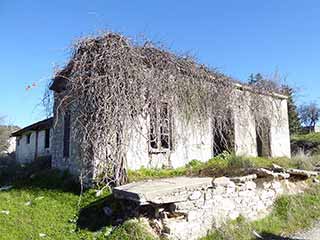
Abandoned Villages - Vretsia
Cyprus has more than it's fair share of abandoned villages. The troubles caused the displacement of both Greek Cypriots and Turkish Cypriots.The environment itself has caused other villages to be abandoned for reasons of safety. Whatever the reason, the abandonment caused emotional pain and suffering to the affected people. So is it right to right a series of blog articles on them? I thought about this for a while, but decided that yes it was. Cyprus is a land built on antiquities, and these villages are just the latest example. I had no problem blogging about a Necropolis after all. However, some of these villages, and especially Ventris, do still get visits from the displaced families. So if you do decide to visit these places on the strength of these articles, please bear that in mind, and treat them with respect. The urban exploring motto "take only pictures, leave only footprints..." nicely sums it up.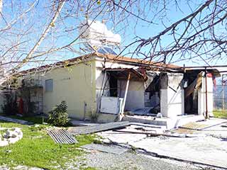
Vretsia Tavern
We recently did a blog on the abandoned village Vretsia. Until recently, a tavern still operated there. Unfortunately, last summer it appears to have burnt down. It is now a very eerie place to visit...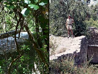
Roudia Bridge Time Warp
An old photograph, showing a young man standing on top of a broken Venetian Bridge got us excited recently. It looked a bit like Roudia, but the rock outcrop in the background seemed in the wrong place. There was only one way to find out for sure...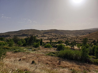
The Xeros Valley
The Xeros Valley should be the goto destination for anybody who wants to experience off-roading in Cyprus without running the gauntlet of assorted buggies and ATVs you find on the Akamas in mid-summer. This article is a summary of the recent Facebook journey we made up it, from the sea to Paphos Forest.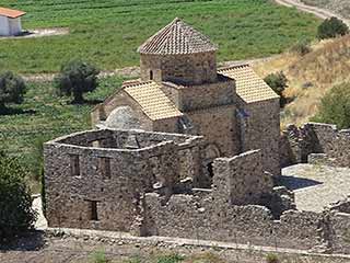
Sinti Monastery
It's time for another guest blog, and this time Max has taken a break from his minerals to show us somewhere a bit more spiritual. Over to you Max... Sinti Monastery is a very important ancient monument and not far away from Paphos, in the beautiful Xeros River Valley. I thought I would take a round trip. In order that people can visit the place all year round (even after a good Winter's rain) in a normal car I took the longer route over the hills where the roads nowadays are all properly surfaced. On the way back you can either take the same road (Winter) or use the short cut along the Xeros river bed which is only 8 km until the next village Nata.Related Pages

MapPaphos Country Sightseeing
We have recently had friends from the UK visiting, and naturally took them to see some of the treasures of Paphos that are away from the usual tourist's eye. In this article we explore the top part of the Xeros Valley, take in an abandoned village and a beautiful Venetian Bridge.
Good Pages To Visit

FB PagePaphos Life on Facebook
Like us on Facebook and stay notified of new blog posts.

FB PageOur Facebook Chat Group
Paphos Chat has been created for people who like our site and want to chat using Facebook. You can also easily upload photos of any size here. A lot of people are members of the Facebook chat group and the main forum. It's entirely up to you.

ListBlog Locations
Planning a day out? Then use our map of blog locations as a handy guide. Some of the places we visit our closer to each other than you might think, so take a look and start planning your next adventure...

eBookCyprus Road Trip 01: the Kathikas - Panagia Loop
Let me take you on a journey around the region of Paphos, Cyprus. Starting at Paphos itself, we travel to Akoursos, then Kathikas, Kritou Terra and Simou. We continue past Lasa and Kannaviou, before taking in the delights of Panagia. Getting a bit more adventurous, we visit the abandoned villages of Statos and Agios Fotios, before passing through Choulou, Letymbou and Polemi, and rejoining the main Paphos - Polis road.
The route is suitable for all types of vehicle, and requires no off-roading. The guide contains about 130 photographs including shots of all the road signs you need to pay attention to, as well as some of the highlights you may experience along the way.
There are also several maps which will help you keep your bearings.
You can do this journey in a day, or you can break it up into chunks. You can also do it in reverse, to get some completely different views. It is entirely up to you.


