Souskiou Cemetery
Dem Bones

I don't think that this is as macabre as it looks. More likely, a farmer has been using this as a convenient dump for animal carcasses.

One More Tomb

One thing I don't get about these tombs, is what did they have for roofs? The smaller holes had lids. You can see some of them in the next photo. But there's no way these tombs could have been covered like that. So were they just filled in with soil? They aren't like the tombs at Meletis Forest Necropolis which had chambers.
Remains of Lids

In the field next to the cemetery you can see where the lids of the smaller graves had been dumped. Whether they were left here by looters or archaeological digs I don't know.
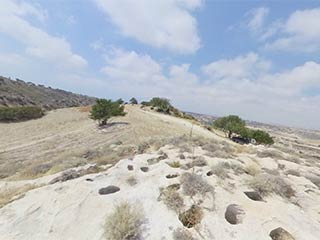
Anyway, that's enough looking at cemeteries. What about the settlement itself? For that we need to go back across the canyon...
Back Where We Started

Here we are again, and you can see the second cemetery we just visited on the opposite side of the canyon.
Green Tarpaulin.

We shall have a look at the area near the green tarpaulin first. Please note the drop to the side though. If you are exploring around here you need to take care and wear sensible footwear. If you can stand it in the heat, I would strongly recommend a pair of jeans as well. The local vegetation was very prickly.
Page 6 of 10


Related Blogs:
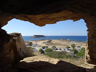
Cape Drepanum
It's time for another guest blog from Max. This time, he's been to the edge of the Akamas, to have a look at some of the caves at Cape Drepanum. Over to you, Max...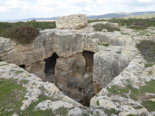
The Necropolis at Meletis Forest
If you drive to the Akamas along the coastal road, you will eventually come off the main road and onto a side road leading to the Akamas proper. Before you go past the Searays cafe bar, you will see a nondescript sign on your right, next to a layby.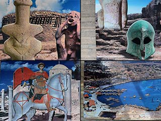
The History of Paphos in 16 Pictures
When I was out photographing a new statue in Old Paphos the other week, I stumbled upon a walkway I hadn't seen before. It descended to the lower carpark, by the Turkish Baths. The walkway was adorned with pictures telling the story of Paphos through the ages. Judging by the state of some of the pictures. they had obviously been there for some time, but this was the first I had seen of them. Here they are for your perusal...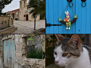
Pano Arodes
Pano Arodes is one of the gateways to the Akamas. It is a charming village between Kathikas and Droushia. We will be featuring it in our next eBook, so recently visited it to do some research. Naturally enough, we took lots of pictures while we were there...Related Pages

MapSouskiou Cemetery
Last spring we blogged about our visit to the abandoned village of Souskiou in the Diarizos Valley. We received numerous comments, some of which alluded to an ancient cemetery that lurked in the nearby hills. Well, this naturally piqued our curiosity, and we resolved to track them down. Over the next few months we made numerous excursions, and this is a summary of what we found...
360 PanoramaSouskiou Cemetery
In the hills above the abandoned village of Souskiou, in the Diarizos Valley, there are an assortment of ancient cemeteries and settlements. Let's take a look...
Good Pages To Visit

FB PagePaphos Life on Facebook
Like us on Facebook and stay notified of new blog posts.

FB PageOur Facebook Chat Group
Paphos Chat has been created for people who like our site and want to chat using Facebook. You can also easily upload photos of any size here. A lot of people are members of the Facebook chat group and the main forum. It's entirely up to you.

ListBlog Locations
Planning a day out? Then use our map of blog locations as a handy guide. Some of the places we visit our closer to each other than you might think, so take a look and start planning your next adventure...

eBookCyprus Road Trip 01: the Kathikas - Panagia Loop
Let me take you on a journey around the region of Paphos, Cyprus. Starting at Paphos itself, we travel to Akoursos, then Kathikas, Kritou Terra and Simou. We continue past Lasa and Kannaviou, before taking in the delights of Panagia. Getting a bit more adventurous, we visit the abandoned villages of Statos and Agios Fotios, before passing through Choulou, Letymbou and Polemi, and rejoining the main Paphos - Polis road.
The route is suitable for all types of vehicle, and requires no off-roading. The guide contains about 130 photographs including shots of all the road signs you need to pay attention to, as well as some of the highlights you may experience along the way.
There are also several maps which will help you keep your bearings.
You can do this journey in a day, or you can break it up into chunks. You can also do it in reverse, to get some completely different views. It is entirely up to you.


