The Paphos to Polis Motorway - Part 1
Map 1

This shows where the new motorway will leave the A6.
Photo Map 1

This map shows where we were standing when we took the relevent pictures. The number will appear at the bottom left of each picture, so you will get a better idea of what you are looking at.
Before We Begin

This picture shows the motorway directly after the proposed junction, which will be sited to the left of the ridge the motorway turns in front of.
Junction Site

This is pretty much in the middle of the proposed junction, looking towards the sea.
Existing Track

There is an existing track that goes from here to Marathounta. In the winter we did a blog about dam building, showing a road that had been washed away. This is the same road, but further up. According to the plan, the motorway will run just to the right of this picture. This makes sense, as you would want to avoid the valley floor, for obvious reasons.
Incidentally, you can still get to Marathounta from here. The road in the valley has just been rerouted. Cypriots are very good at maintaining these routes.
Page 2 of 9

Related Blogs:
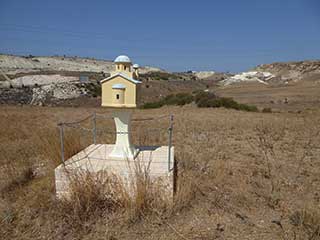
The Shrine by the Motorway
Every time I drive to Limassol on the A6, I notice a shrine in a field to the left of the motorway, soon after you leave Paphos. The other day while out exploring, we found ourselves close by, so we thought we would take a look...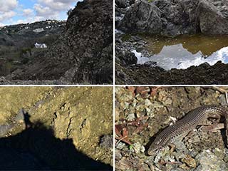
Dam Busters
The recent rains are very good for the reservoirs, and they also rejuvenate dried-up riverbeds and streams. So the other day we revisited some old haunts to see what effect the rain had had on them, and perhaps build a dam or two...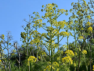
Cyprus Giant Fennel
The spring flowers in Cyprus are starting to bloom, and some are more prominent than others. The giant fennel is one such plant. It can dominate an area and put on a stunning display, as we shall see...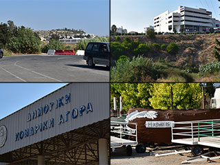
Geroskipou Bypass
It has been announced that there is to be a new bypass built between Paphos and Geroskipou. Responses to this news were mixed, but we think it is a good idea. We decided to visit the area to see where the bypass will go and who it will benefit. Besides, the map had shown that there was a flea market in the area. What was that all about...?Related Pages

MapThe Paphos to Polis Motorway - Part 1
A new motorway is coming to Paphos. It will link the existing A6 motorway to the North West coast of the island, reduce travel time, and aid congestion on the B7. That's the plan, anyway. Alternatively, it will destroy precious natural areas and be an expensive waste of money. We decided to take a look at the proposed route for ourselves, so now at least you will know exactly where the motorway will go. Possibly.
Good Pages To Visit

FB PagePaphos Life on Facebook
Like us on Facebook and stay notified of new blog posts.

FB PageOur Facebook Chat Group
Paphos Chat has been created for people who like our site and want to chat using Facebook. You can also easily upload photos of any size here. A lot of people are members of the Facebook chat group and the main forum. It's entirely up to you.

ListBlog Locations
Planning a day out? Then use our map of blog locations as a handy guide. Some of the places we visit our closer to each other than you might think, so take a look and start planning your next adventure...

eBookCyprus Road Trip 01: the Kathikas - Panagia Loop
Let me take you on a journey around the region of Paphos, Cyprus. Starting at Paphos itself, we travel to Akoursos, then Kathikas, Kritou Terra and Simou. We continue past Lasa and Kannaviou, before taking in the delights of Panagia. Getting a bit more adventurous, we visit the abandoned villages of Statos and Agios Fotios, before passing through Choulou, Letymbou and Polemi, and rejoining the main Paphos - Polis road.
The route is suitable for all types of vehicle, and requires no off-roading. The guide contains about 130 photographs including shots of all the road signs you need to pay attention to, as well as some of the highlights you may experience along the way.
There are also several maps which will help you keep your bearings.
You can do this journey in a day, or you can break it up into chunks. You can also do it in reverse, to get some completely different views. It is entirely up to you.


