Argaka Dam
Low Water

We need rain now.

The Trail Continues

We went as far as the dam. The trail continued though. We will return soon in our 4x4, and continue up there. It would be nice to make it cross country all the way to Pera Vasa or Vretsia.
Edge of the Fire Damage

You can see in the distance how far the fire progressed. Putting it out was a major operation. The helicopters didn't use water from the reservoir though. Instead, they took it from the nearby sea. They can get away with this when the fire is close to the beaches. We saw a fire recently, near Theletra. In that instance, the emergency services had to use the nearby Evretou Reservoir.
And So... To Rubbish

Now that the children have seen the dam, it is time to walk back collecting rubbish. I haven't photographed them doing this for two reasons. Firstly, for privacy, and secondly, because I was also picking rubbish up. Being a bit gung-ho, I spent most of the time fighting my way through brambles to get estranged bottles and cans. At one point I was scrambling up the banks of a dried up stream, and couldn't help but notice the tell tale date and time stamp that signified the mosquito sprayers had been out on patrol.
The Booty

And there you have it. Eight bags of rubbish, and a baby carrier. Considering how tidy the route was, this was very good going.
It's nice to see kids getting involved in rubbish clearing. The more they are made aware of the litter problem the better. Hopefully, they will be less likely to throw a crisp packet out of a car window in future. And they are certainly aware of the damage that forest fires can do.
Well done kids!
Page 4 of 4


Related Blogs:
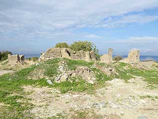
Abandoned Villages - Makounta
We recently assisted on a litter cleanup along the nature trail to Argaka Reservoir. While we were there, we couldn't help but notice the abandoned village of Makounta on the other side of the valley. We were also curious where the nature trail went once it passed the reservoir. So the other day we returned with our camera. This is what we found...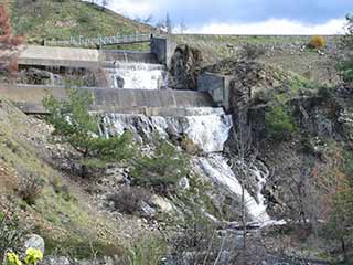
Argaka Overflow
This morning we read a news article which said the Argaka Dam was full. We recently visited Argaka to help clean the nature trail, so we were keen to see what it looked like when full...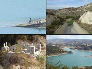
Evretou Dam
Ever since we explored the abandoned villages of Evretou and Trimithousa, we have been meaning to return and have a look at the rest of the reservoir. A chance wrong turn gave us just the opportunity we needed, so off we went. It took us a few visits to get the full picture of the reservoir, but we saw some lovely scenery along the way...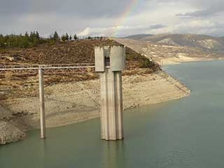
Should We Be Worried About Our Water?
Over the last few years, the water level in the Asprokremmos has gotten lower and lower. Should we be alarmed? Has it been this low before?Good Pages To Visit

FB PagePaphos Life on Facebook
Like us on Facebook and stay notified of new blog posts.

FB PageOur Facebook Chat Group
Paphos Chat has been created for people who like our site and want to chat using Facebook. You can also easily upload photos of any size here. A lot of people are members of the Facebook chat group and the main forum. It's entirely up to you.

ListBlog Locations
Planning a day out? Then use our map of blog locations as a handy guide. Some of the places we visit our closer to each other than you might think, so take a look and start planning your next adventure...

eBookCyprus Road Trip 01: the Kathikas - Panagia Loop
Let me take you on a journey around the region of Paphos, Cyprus. Starting at Paphos itself, we travel to Akoursos, then Kathikas, Kritou Terra and Simou. We continue past Lasa and Kannaviou, before taking in the delights of Panagia. Getting a bit more adventurous, we visit the abandoned villages of Statos and Agios Fotios, before passing through Choulou, Letymbou and Polemi, and rejoining the main Paphos - Polis road.
The route is suitable for all types of vehicle, and requires no off-roading. The guide contains about 130 photographs including shots of all the road signs you need to pay attention to, as well as some of the highlights you may experience along the way.
There are also several maps which will help you keep your bearings.
You can do this journey in a day, or you can break it up into chunks. You can also do it in reverse, to get some completely different views. It is entirely up to you.


