Akamas Summer Drive
Map Marker

Ok, so I have walked up to the top of the hill, leaving Alex to her butterflies. This is the map marker I was referring to, and beyond that you can see the far reaches of the Akamas. We came up here when the fires were ablaze, as we could take pictures without being anywhere near to the fire, and, more importantly, the fire fighters.
Scorched Earth

From a distance, it is less obvious that there was a fire there now. Grasses have grown up over winter, and have now turned golden brown, so the ashen soil now blends in with the surrounding landscape. The skeletal trees are the big giveaway now.
Back To The Car

Walking back down to the car, the landscape here doesn't look too dissimilar to the burnt areas.
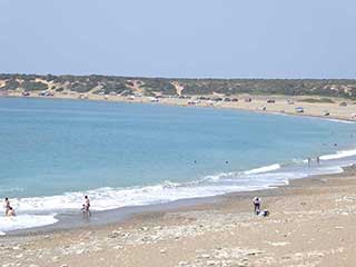
Towards Polis

Continuing down the track towards Neo Chorio and Polis, we will soon be able to get a closer look.
Interesting Ledge

Just down from the map marker, the road takes a right. At that point, you are running along the top of the ridge, and you can get a lovely view if you park up and walk up to these rocks. Don't block the road though.
Page 6 of 7


Related Blogs:
The Akamas By Car
Nothing beats exploring the Akamas by car. A decent 4x4 can take you to places you would never normally find on foot, and the aircon can be a real life-saver. Some routes into the Akamas are bumpier than others. In this blog take a relatively bump free route which would suite the more cautious amongst you.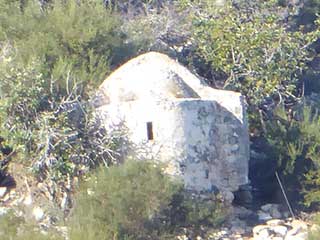
If You Go Down To The Woods Today...
If you have ever driven to the Blue Lagoon via the coastal road, you can be forgiven for not spotting this delightful little church en route.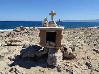
The Far Side of the Akamas
Last October when I had the weekend to myself, I resolved to do a geocache that had eluded me up until now, due to it's remoteness. Given that people were interested in the Akamas Church blog I posted a while back, I thought I would turn the photos I took into another blog...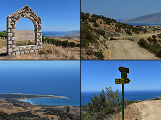
Akamas Summer Drive
Last year there were a number of fires on the Akamas. We thought we would take a ride along the top and see how nature was recovering. So we started at Ineia and took the track towards Smigies Picnic Area. Join us for some amazing views...Related Pages

MapAkamas Summer Drive
Last year there were a number of fires on the Akamas. We thought we would take a ride along the top and see how nature was recovering. So we started at Ineia and took the track towards Smigies Picnic Area. Join us for some amazing views...
Good Pages To Visit

FB PagePaphos Life on Facebook
Like us on Facebook and stay notified of new blog posts.

FB PageOur Facebook Chat Group
Paphos Chat has been created for people who like our site and want to chat using Facebook. You can also easily upload photos of any size here. A lot of people are members of the Facebook chat group and the main forum. It's entirely up to you.

ListBlog Locations
Planning a day out? Then use our map of blog locations as a handy guide. Some of the places we visit our closer to each other than you might think, so take a look and start planning your next adventure...

eBookCyprus Road Trip 01: the Kathikas - Panagia Loop
Let me take you on a journey around the region of Paphos, Cyprus. Starting at Paphos itself, we travel to Akoursos, then Kathikas, Kritou Terra and Simou. We continue past Lasa and Kannaviou, before taking in the delights of Panagia. Getting a bit more adventurous, we visit the abandoned villages of Statos and Agios Fotios, before passing through Choulou, Letymbou and Polemi, and rejoining the main Paphos - Polis road.
The route is suitable for all types of vehicle, and requires no off-roading. The guide contains about 130 photographs including shots of all the road signs you need to pay attention to, as well as some of the highlights you may experience along the way.
There are also several maps which will help you keep your bearings.
You can do this journey in a day, or you can break it up into chunks. You can also do it in reverse, to get some completely different views. It is entirely up to you.


