Marathounta Wilderness
Distant Ruins

Once I had packed the drone away, I set off on foot. I made sure I took plenty of water with me and a fully charged phone. I also had my action camera and there is a film at the end with footage of the visit.
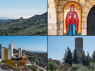
As I set out, I noticed these ruins in the hill to my left. I made a mental note to come back by them, so I could have a closer look.
This Way

There are no real paths to follow here. Occasionally there will be a dried up stream, but for most of the journey I was walking through a mix of rocks and prickly undergrowth. So decent boots are essential. I should have worn long trousers too, but it was too hot for that, so I had shorts on. Consequently my legs got a bit scratched.
Alternate Route

In the distance I could see another faint track descending into the valley. Personally I wouldn't drive down that. The long grass, when driven over, becomes as slippery as ice in places. I found this out on a previous visit.
Valley Floor

I've reached the base of the valley now. This view is heading up to that track I pointed out in the last shot. I want to go the opposite way.
One Last Drone Shot

Before we go into the heart of the wilderness, let's have another drone shot. To the distant left of this shot is Paphos Municipal Dump. In the top centre of the shot is a scrap yard for cars, and to the right of the shot is the motorway. So it is safe to say that this area is not on many people's radars. And yet, it is right next to Paphos.
Page 2 of 6


Related Blogs:
Marathounta Shortcut
During lockdown we have to get our thrills where we can. So when we have to do mundane tasks such as taking the garden waste down to the local recycling centre, we try and make the best of it. Here then, is a picturesque route down to Konia Green Point.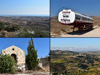
The Paphos to Polis Motorway - Part 1
A new motorway is coming to Paphos. It will link the existing A6 motorway to the North West coast of the island, reduce travel time, and aid congestion on the B7. That's the plan, anyway. Alternatively, it will destroy precious natural areas and be an expensive waste of money. We decided to take a look at the proposed route for ourselves, so now at least you will know exactly where the motorway will go. Possibly.Related Pages

MapMarathounta Wilderness
There's an area near Paphos that is surprisingly remote. I had been meaning to explore it for some time. And now, as they will be starting work on the nearby motorway soon, I thought it was the ideal time to visit. You may never get to Mars, but if you want a feel for what it might be like, you could do worse than take a walk through the countryside near Marathounta.
Good Pages To Visit

FB PagePaphos Life on Facebook
Like us on Facebook and stay notified of new blog posts.

FB PageOur Facebook Chat Group
Paphos Chat has been created for people who like our site and want to chat using Facebook. You can also easily upload photos of any size here. A lot of people are members of the Facebook chat group and the main forum. It's entirely up to you.

ListBlog Locations
Planning a day out? Then use our map of blog locations as a handy guide. Some of the places we visit our closer to each other than you might think, so take a look and start planning your next adventure...

eBookCyprus Road Trip 01: the Kathikas - Panagia Loop
Let me take you on a journey around the region of Paphos, Cyprus. Starting at Paphos itself, we travel to Akoursos, then Kathikas, Kritou Terra and Simou. We continue past Lasa and Kannaviou, before taking in the delights of Panagia. Getting a bit more adventurous, we visit the abandoned villages of Statos and Agios Fotios, before passing through Choulou, Letymbou and Polemi, and rejoining the main Paphos - Polis road.
The route is suitable for all types of vehicle, and requires no off-roading. The guide contains about 130 photographs including shots of all the road signs you need to pay attention to, as well as some of the highlights you may experience along the way.
There are also several maps which will help you keep your bearings.
You can do this journey in a day, or you can break it up into chunks. You can also do it in reverse, to get some completely different views. It is entirely up to you.


