Abandoned Villages - Agios Theodoros
From The Ground
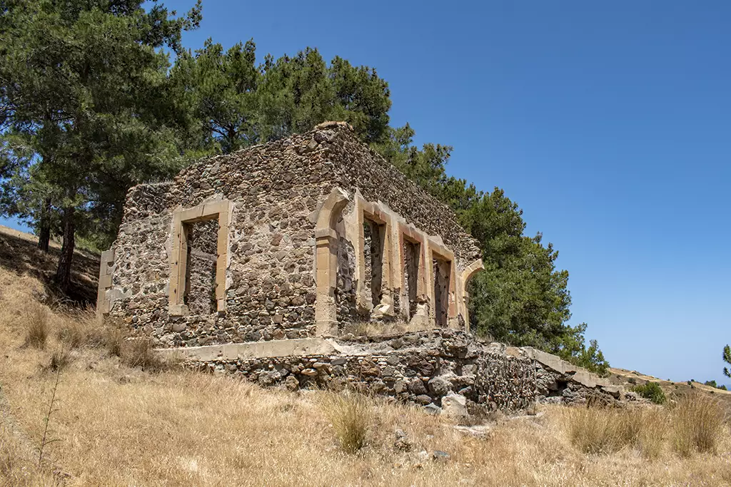
As you approach the building from the track, you can see the walls are built in the same way as the previous house. This differs from the abandoned villages we have seen in the Paphos district. But more on that later.
Historical Population:
From 1891 to 1960, the village was solely inhabited by Turkish Cypriots. Although the population fluctuated in the first decades of the 20th century, it increased steadily from 162 in 1891 to 232 in 1960.

Missing Front
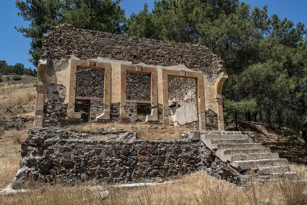
The building appears to be missing a front room. You can see arches that have been half-knocked down.
Displacement:
All the Turkish Cypriot inhabitants of Agios Theodoros/Bozdağ were displaced in 1964. The village was evacuated by UNFICYP in August 1964 when the area was under attack by General Grivas and his Greek Cypriot National Guard during the Tylliria Battle. Most of the Turkish Cypriots of Agios Theodoros/Bozdağ sought refuge in the Turkish Cypriot enclaves of Kokkina/Erenköy(050) and Limnitis/Yeşilırmak(061). They remained in those villages until 1976 when they were once again moved, this time to the Turkish-controlled part of the island, to Yialousa/Yenierenköy(205), a village in the Karpasia/Karpaz peninsula. Some of the Agios Theodoros/Bozdağ villagers chose to stay in Limnitis/Yeşilırmak(061), while others moved to Nicosia(074).
Inside
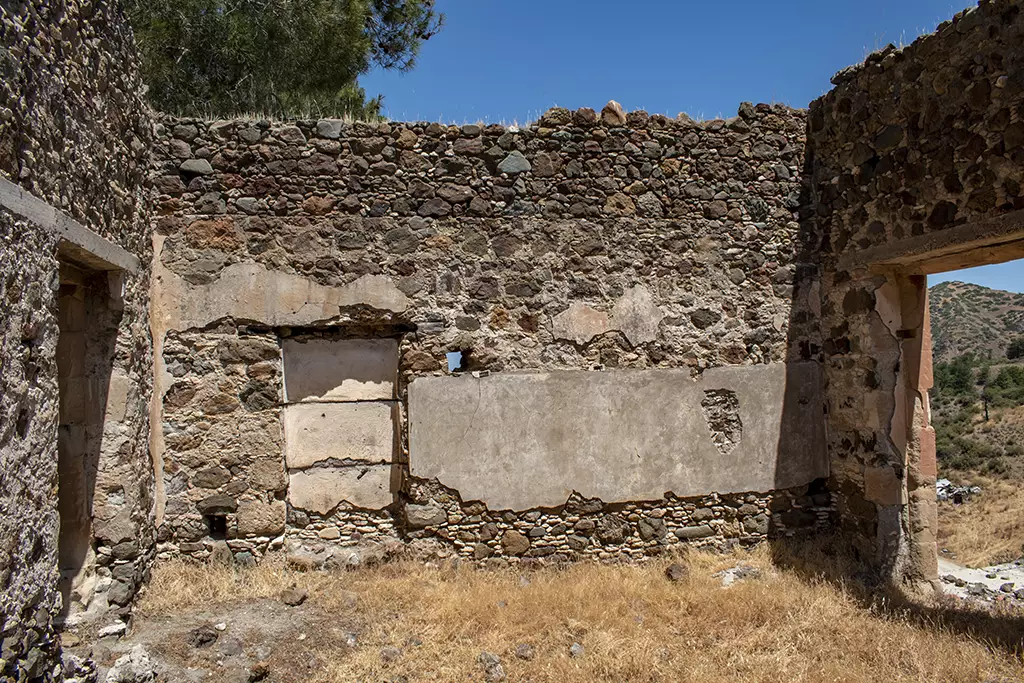
This is why I think this building was a school. This oblong plasterwork would have had a blackboard mounted on it. I have seen this in a number of places, including an abandoned school in Ayios Ioannis. So I know it is definitely school related.
Anyway, that is all the information that PRIO has available. There are two questions still unanswered though. The big elephant in the room is the Tylliria Battle. What exactly was that? Before we get onto that though, I just want to look at that population figure. The 1960 census stated that there were 232 inhabitants. But there are a lot of buildings here. Are some of them just for storing farm equipment? Or are the census figures a bit unreliable?
From Above
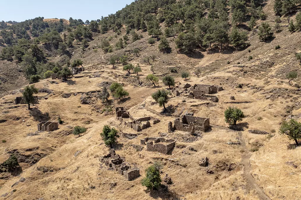
See what I mean? In this shot you can see a lot of buildings, if you look around. And there are more on the other side of the valley. But we are getting ahead of ourselves...
The Next Building
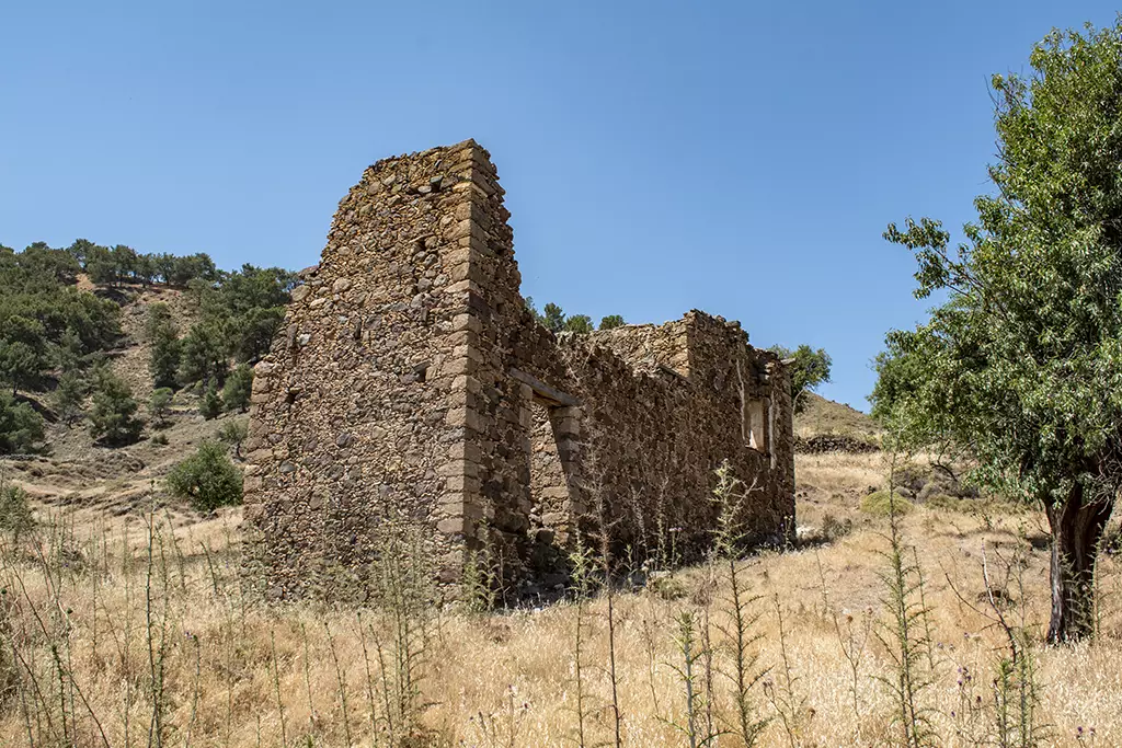
After the school, you need to walk along goat paths to make your way up the hill. This is the first building you will come to. It looks quite imposing, and very solidly built.
Page 6 of 10


Related Blogs:
Good Pages To Visit

FB PagePaphos Life on Facebook
Like us on Facebook and stay notified of new blog posts.

FB PageOur Facebook Chat Group
Paphos Chat has been created for people who like our site and want to chat using Facebook. You can also easily upload photos of any size here. A lot of people are members of the Facebook chat group and the main forum. It's entirely up to you.

ListBlog Locations
Planning a day out? Then use our map of blog locations as a handy guide. Some of the places we visit our closer to each other than you might think, so take a look and start planning your next adventure...
eBookCyprus Road Trip 01: the Kathikas - Panagia Loop
Let me take you on a journey around the region of Paphos, Cyprus. Starting at Paphos itself, we travel to Akoursos, then Kathikas, Kritou Terra and Simou. We continue past Lasa and Kannaviou, before taking in the delights of Panagia. Getting a bit more adventurous, we visit the abandoned villages of Statos and Agios Fotios, before passing through Choulou, Letymbou and Polemi, and rejoining the main Paphos - Polis road.
The route is suitable for all types of vehicle, and requires no off-roading. The guide contains about 130 photographs including shots of all the road signs you need to pay attention to, as well as some of the highlights you may experience along the way.
There are also several maps which will help you keep your bearings.
You can do this journey in a day, or you can break it up into chunks. You can also do it in reverse, to get some completely different views. It is entirely up to you.
