Geroskipou Neapolis Is Coming
Way back in 2019 we reported on an area of Geroskipou which was going to be the site of a new Business DIstrict called the Neapolis. At the time we were interested in a necropolis that was hidden in the woods there. Now, in 2025 they appear to have started construction, so we took the drone down to see what was happening.

As you approach the Neapolis area in Geroskipou you will see it is cordoned off with a "ROAD CLOSED" sign. If you are unsure where this is then take a look at a map we posted on our original Necropolis article.

Area Map

By a kind twist of fate, the "First Photo" label applies to both blog articles, pretty much, so now you know where I took the picture from. And if you are puzzled about the "Pant Man" and "Shrine Caves" labels, then don't be. We will be returning to them soon.
Work In Progress

Sensibly, the first thing they are working on is the infrastructure. If you are at all familiar with Geroskipou you may be aware that the road network further up from here is rather surplus to today's requirements. They have clearly been developing it for a while to cope with future increased traffic. The Neapolis will explain why.
Information

Back in 2019 there wasn't much information on the Neapolis. Now though all that has changed. The Leptos Estate website has a big section on it.
Neapolis is one of the most significant planned mixed use developments of its kind in the Mediterranean and probably in Europe given its size, scope, unique character and eco-smart principles. It involves the development of a truly 21st century city in an area of 1,100,000 sqm with a net buildable area of 777,000 sqm that will combine a wide range of residential product options with a synthesis of key lifestyle enhancing elements, including a leisure & entertainment park, a commercial park, the Neapolis University Campus, a Health Park with a hospital and a wellness centre, an Office Park, a Cultural Park and green parks of 200,000 sqm.

One thing that puzzles me about the Leptos Estate website is this map. According to that, the new city's top border is the road they are currently building.
Page 1 of 4

Related Blogs:
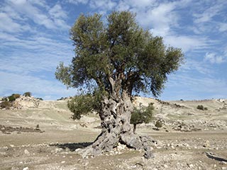
Is this the Oldest Olive Tree in Cyprus?
We were out exploring in the Akamas the other day, and we came across this lovely old Olive Tree. I can't help wondering how long it has stood here...Related Pages

MapGeroskipou Neapolis Is Coming
Way back in 2019 we reported on an area of Geroskipou which was going to be the site of a new Business DIstrict called the Neapolis. At the time we were interested in a necropolis that was hidden in the woods there. Now, in 2025 they appear to have started construction, so we took the drone down to see what was happening.
Good Pages To Visit

FB PagePaphos Life on Facebook
Like us on Facebook and stay notified of new blog posts.

FB PageOur Facebook Chat Group
Paphos Chat has been created for people who like our site and want to chat using Facebook. You can also easily upload photos of any size here. A lot of people are members of the Facebook chat group and the main forum. It's entirely up to you.

ListBlog Locations
Planning a day out? Then use our map of blog locations as a handy guide. Some of the places we visit our closer to each other than you might think, so take a look and start planning your next adventure...

eBookCyprus Road Trip 01: the Kathikas - Panagia Loop
Let me take you on a journey around the region of Paphos, Cyprus. Starting at Paphos itself, we travel to Akoursos, then Kathikas, Kritou Terra and Simou. We continue past Lasa and Kannaviou, before taking in the delights of Panagia. Getting a bit more adventurous, we visit the abandoned villages of Statos and Agios Fotios, before passing through Choulou, Letymbou and Polemi, and rejoining the main Paphos - Polis road.
The route is suitable for all types of vehicle, and requires no off-roading. The guide contains about 130 photographs including shots of all the road signs you need to pay attention to, as well as some of the highlights you may experience along the way.
There are also several maps which will help you keep your bearings.
You can do this journey in a day, or you can break it up into chunks. You can also do it in reverse, to get some completely different views. It is entirely up to you.


