Here's a shot I took in June 2003 of the same beach, Max. As you can see, I'm up on the sharp right bend, where the road then dives steeply down to the hairpin bend across the Aspros, then climbs up past the White River Tavern.
No doubt it's been tarmacced or concreted by now, but in those days, the hairpin is where the tarmac ended and the loose surface track began. Taverna staff used to hose down the section of track climbing uphill past their restaurant regularly, to dampen down the dust kicked up by passing motors and stop it wafting into their premises.
The track down " << To the Sunday Beach" was on the left, just after the hairpin, just before the taverna. So the quaint sign I referred to was also on the left, opposite side of the road to the tavern, leading you down alongside the Aspros bed.
I never knew that this particular location was once an ancient Neolithic settlement, crikey! We learn something new here every day on PL!
Cheers- AL

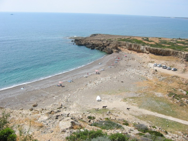
- White River B.JPG (140.98 KiB) Viewed 5404 times
Gone but not forgotten...