Page 1 of 1
Kallepeia Countryside in 360!
Posted: Sun Jan 30, 2022 7:35 pm
by Dominic
In this trip we dip into the Ezousa Valley from above Episkopi. First port of call is the abandoned village of Moronero. This is now nothing more than a church ruin and a few bits of rubble. From there we head down a very beautiful offshoot of the Ezousa Valley towards Kallepeia. Much of this trip is suitable for 4x4s only, and mountain bikes. If you take this journery yourself you will notice a Bus Stop on the way. There used to be a route from Kallepeia to Ezousa. It would have been a bumpy ride but very scenic!
https://www.youtube.com/watch?v=1VtlJe5NB04
To enjoy 360 films you must watch them at a high a resolution as possible. Ramp the resolution up to 5K if you can. If it looks excessively blocky it is because your resolution is set too low.
Once you are viewing the film, you can move the camera about to look at whatever you like. On a tablet, or phone, just swipe in the way you want to go. On a computer, use the mouse or the W,A,S and D keys to point the camera. If you pause the film, you can still move the camera about.
For a map of the route, see here:
https://www.paphoslife.com/film/kallepe ... e-360-2201
Re: Kallepeia Countryside in 360!
Posted: Sat Feb 05, 2022 12:20 am
by Anarita John
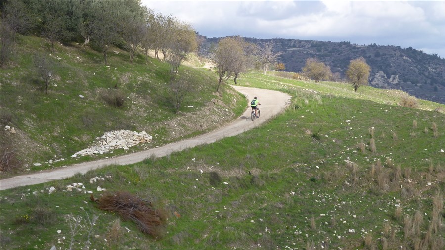
Almost the same route as Rach and I did on our bikes. Me on my e bike and Rach on my old mountain bike. A brilliant ride and a fantastic day out with my daughter. Plus, I still had around 50% battery left when I got back to Anarita.
- P1050698.jpg (203.07 KiB) Viewed 1006 times
We set off from the bridge over the River Ezousa at Episkopi. This route forms part of the Episkopi, Ezousa Trail and also the E4 European footpath. After a short distance, we turned left onto a very steep path up to the main path.
- P1050700.jpg (149.87 KiB) Viewed 1006 times
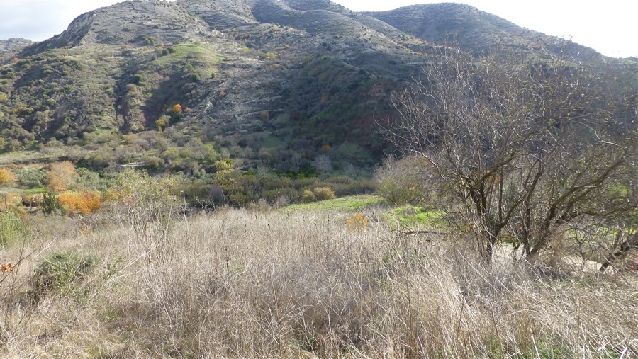
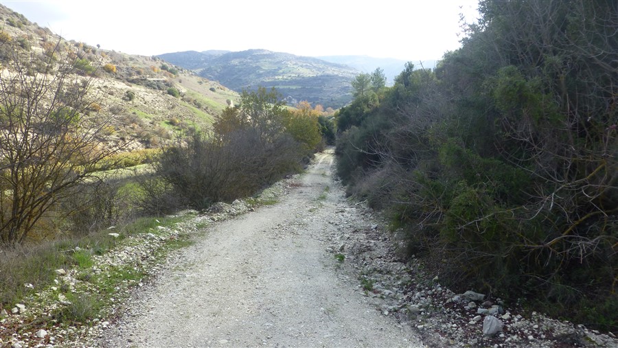
Quite a steep path but beautiful scenery.
- P1050703.jpg (157.08 KiB) Viewed 1006 times
- P1050708.jpg (141.38 KiB) Viewed 1006 times
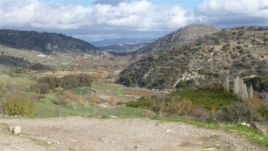
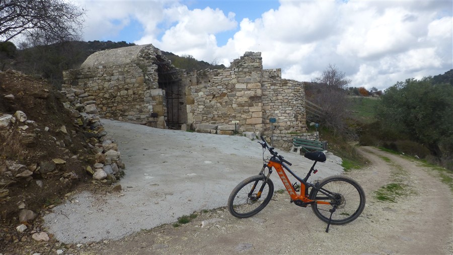
Biserica Sf Ghenadie at Morenero. The first time I did this route, I sat on this bench for my lunch.
Just after the church, I forked to the left. Previously, I had cycled straight on and then down to the valley bottom to the river, which, even in late November, was too deep for me to cross.
- P1050709.jpg (166.52 KiB) Viewed 1006 times
Re: Kallepeia Countryside in 360!
Posted: Sat Feb 05, 2022 12:35 am
by Anarita John
Re: Kallepeia Countryside in 360!
Posted: Sat Feb 05, 2022 12:43 am
by Anarita John
Re: Kallepeia Countryside in 360!
Posted: Sat Feb 05, 2022 8:18 am
by cyprusmax47
Thank you for posting that photos, John. Reminded me of a large walk I did years ago when I was more fit than now.
I was walking down the very steep track from Minthis Hills you mentioned (before they built all the houses there) visiting the ruins of the church and down to Ezousa valley. From there back to Minthis area via a small side valley on the left of the normal road. Quite a lot of meters in height.
Max
Re: Kallepeia Countryside in 360!
Posted: Sat Feb 05, 2022 10:22 am
by Anarita John
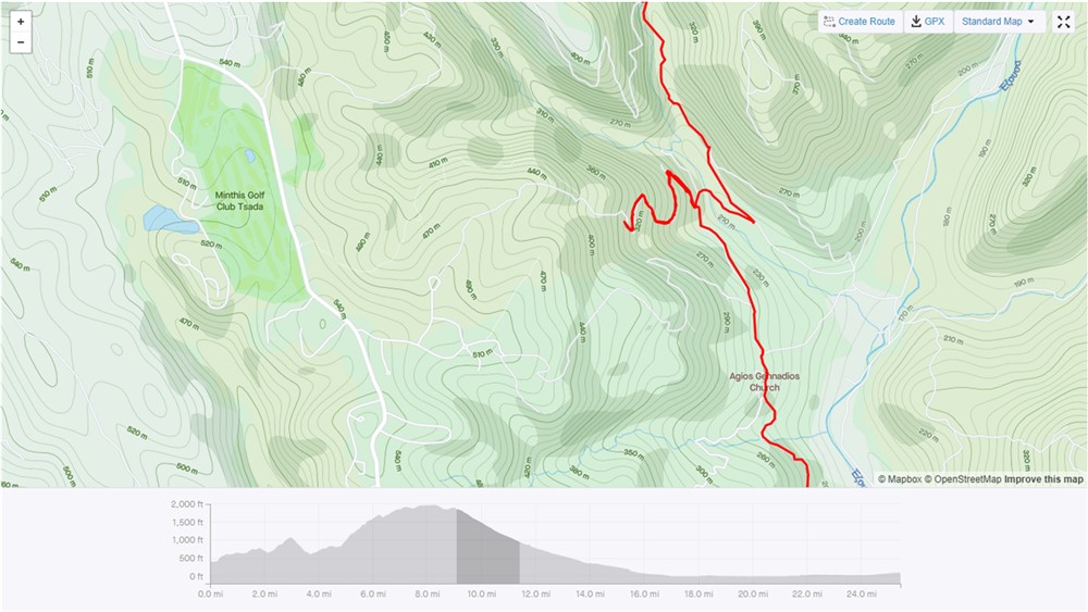
- Picture1 ezousa (1000 x 563).jpg (129.33 KiB) Viewed 958 times
This was the path we had intended to take. Very steep and far to rutted for me, so we walked up most of it, before deciding to turn round and make our way to the tributary of the Ezousa which we were able to cross. It was uphill all the way to Kallepia, and then to Tsada. At our highest point, just outside Tsada, we were 610 metres above sea level.
However, it was a fantastic day out. I would have not have been able to do it on an ordinary bike, but my new ebike, with a 650 watt battery and Bosch motor coped with it brilliantly and a more experienced rider would have coped with the path to Minthis Hills.